

PRODUCT
HOME>PRODUCT>Greenvalley International
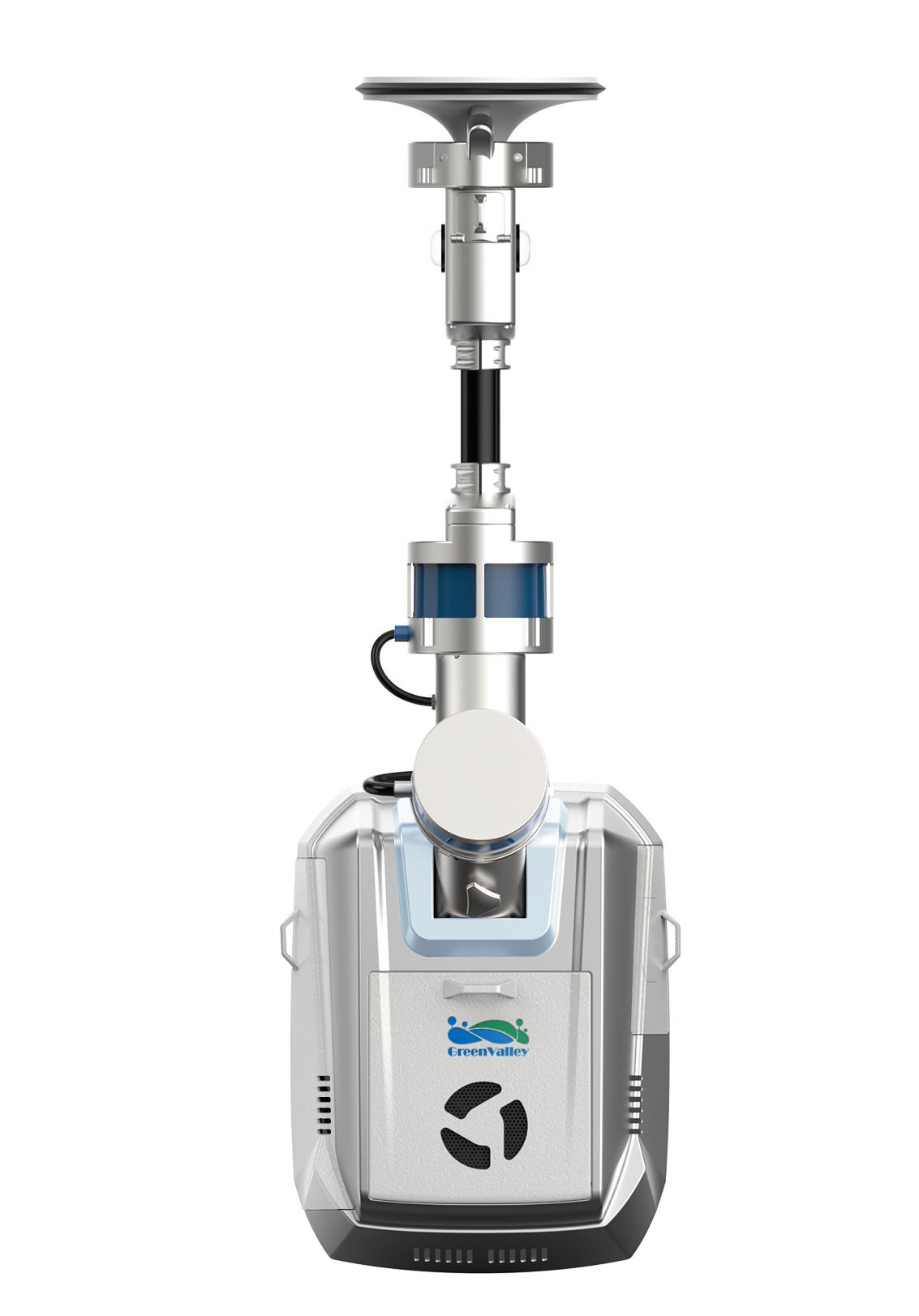
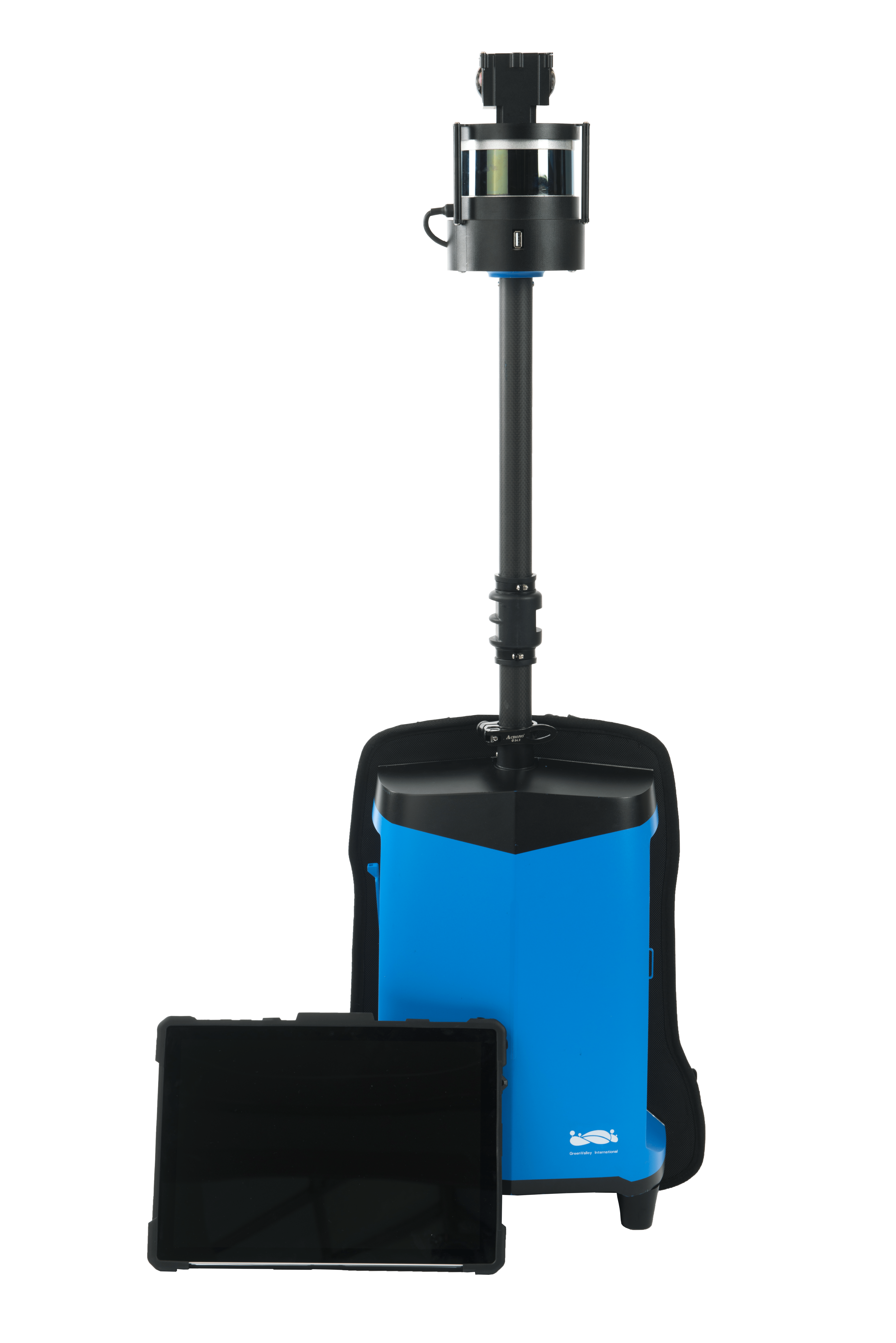
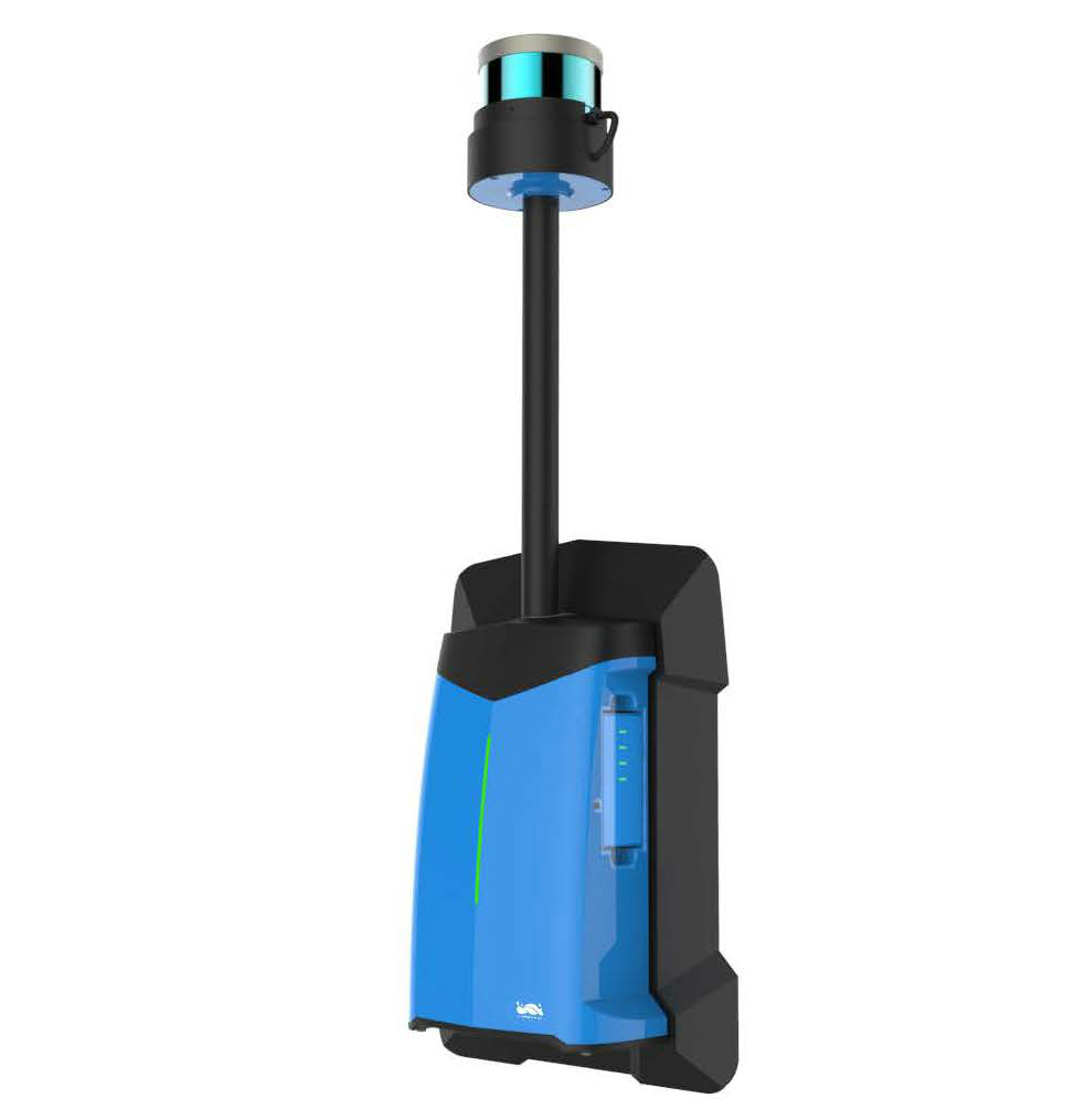
LiBackpack DGC50
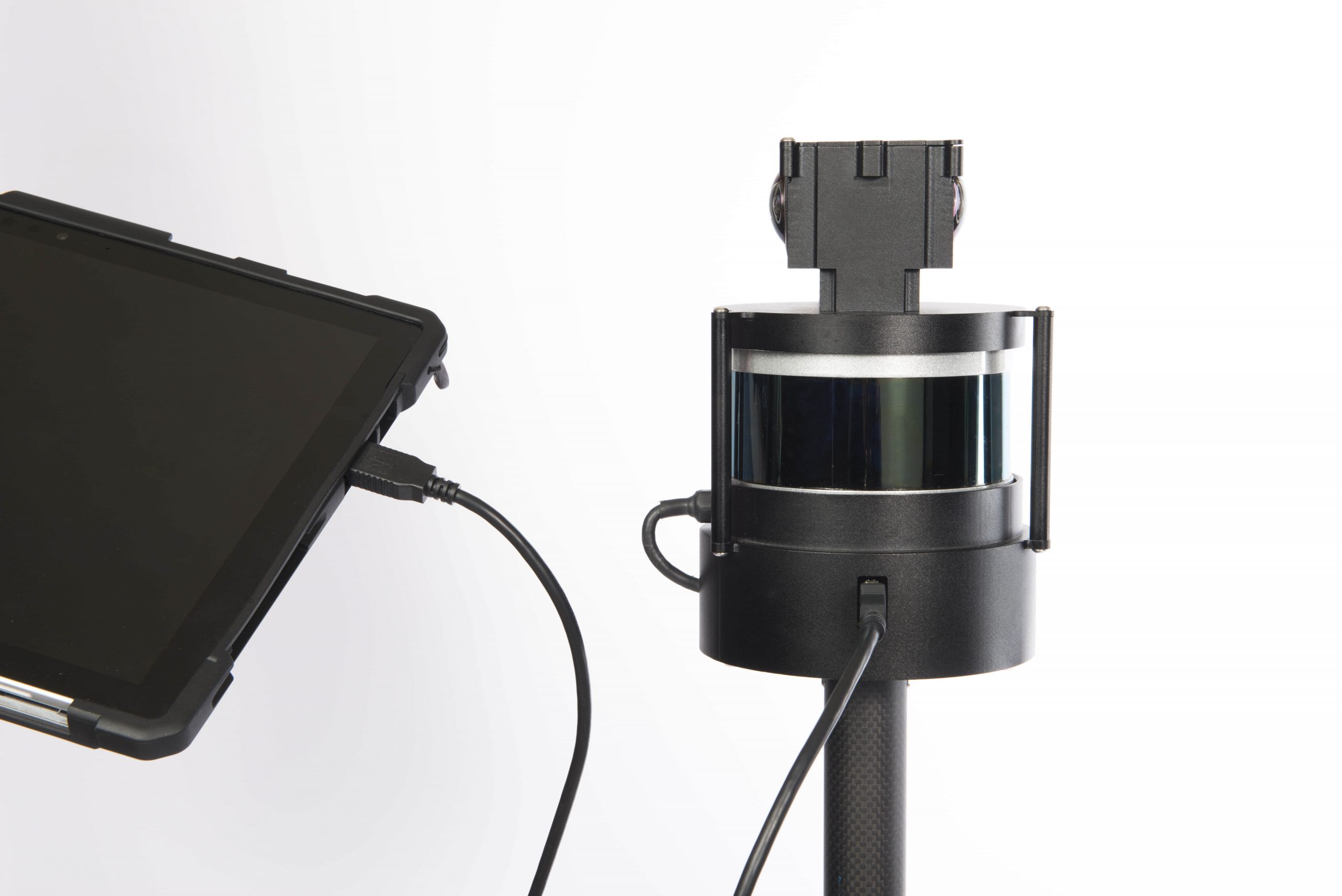
LiBackpack DGC50 LiDAR scanning system is the multi-sensor integrated version of the LiBackpack series, including a horizontal and vertical LiDAR sensor, a high-resolution panoramic camera and a precise GNSS module. With integrated SLAM and GNSS navigation technology, it can obtain georeferenced high-resolution panoramic image and high-precision 3D point cloud data even with high accuracy (≤5cm). LiBackpack DGC50 is a powerful tool for powerline inspection, forest management and survey, mining industry, underground space information acquisition, BIM, and so on.
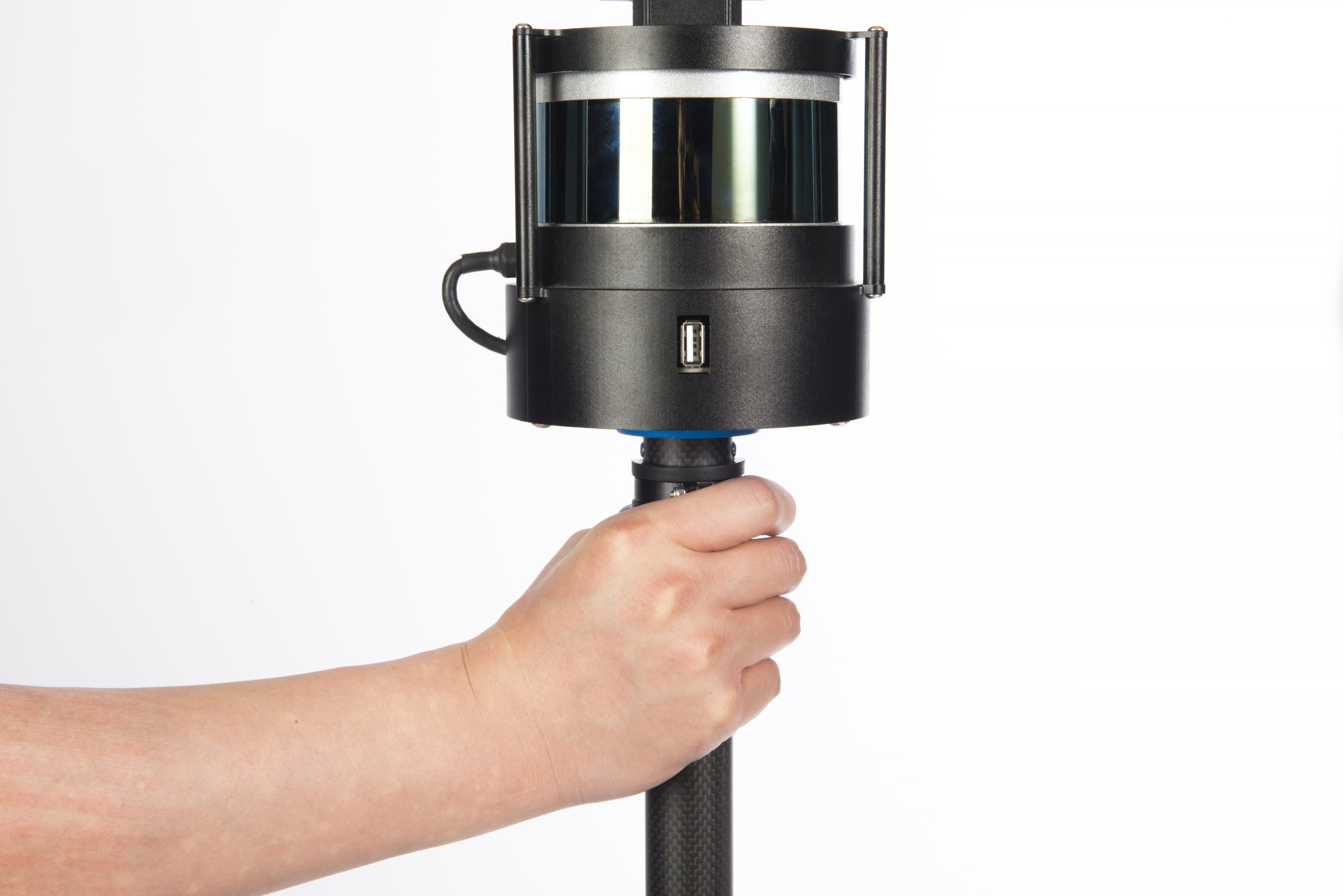
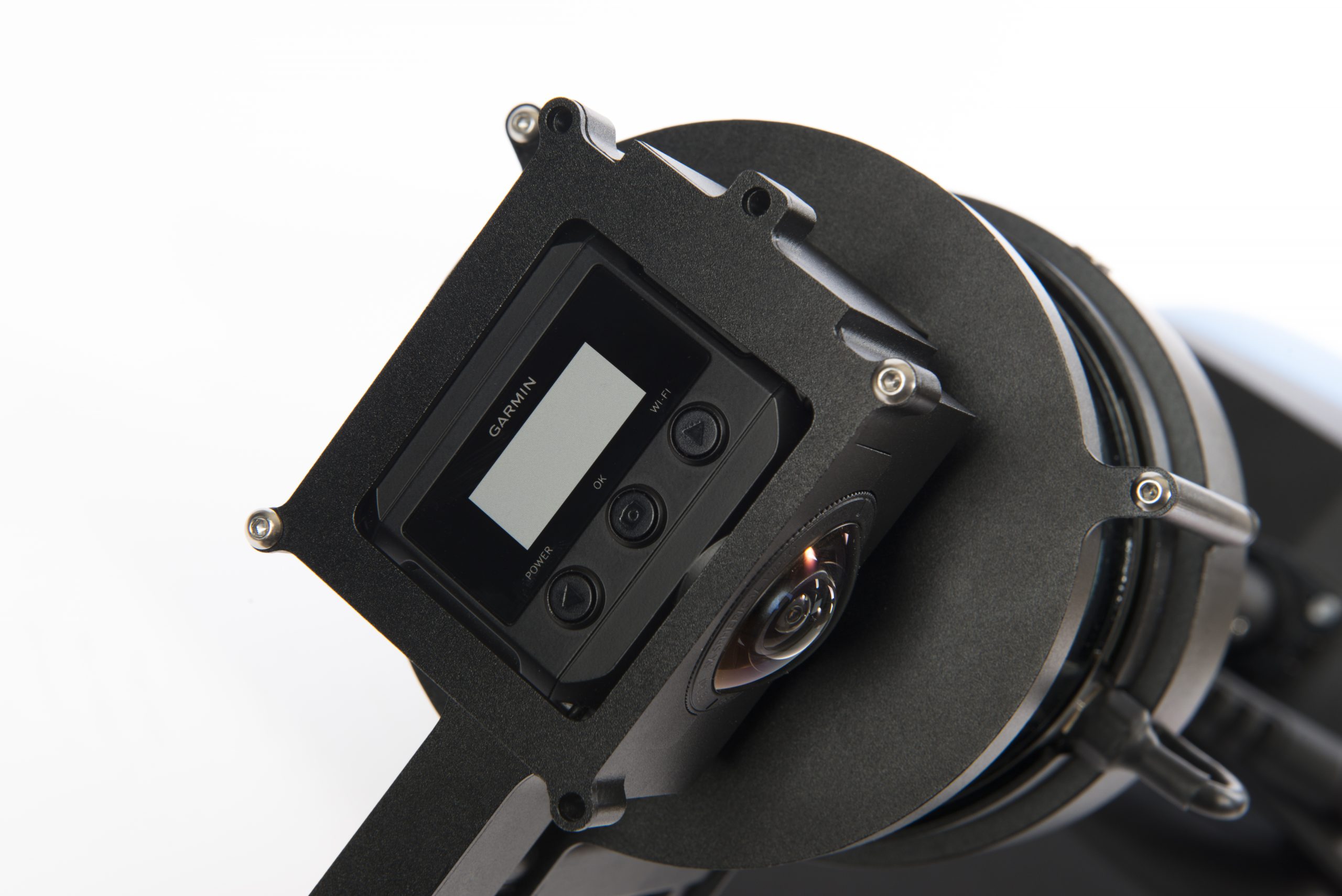
GNSS + Double LiDAR Sensors Integration + 360° Camera
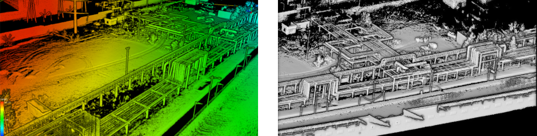
All-environment mapping
Capture 3D colored point cloud data and map any environment with a 10 times higher speed.
High precision
Capture lidar point cloud data with absolute spatial coordinates in centimetre-level accuracy.
High-flexibility operation
Could be mounted on various mobile platforms, e.g., bike, motorcycle, etc.
Software support
Optimize the collected data using the provided LiFuser-BP software 3 times faster.
LiBackpack DG50
LiBackpack DG50 is an upgraded version of GVI’s dual-sensor laser scanning system, LiBackpack D50. With a GNSS module onboard, the LiBackpack DG50 provides 3D point cloud model with highly accurate positioning information. With just a 500 grams increase in weight, the newly designed LiBackpack DG50 gives you absolute positioning function along with all the advantages of LiBackpack D50.
GNSS + Double LiDAR Sensors Integration
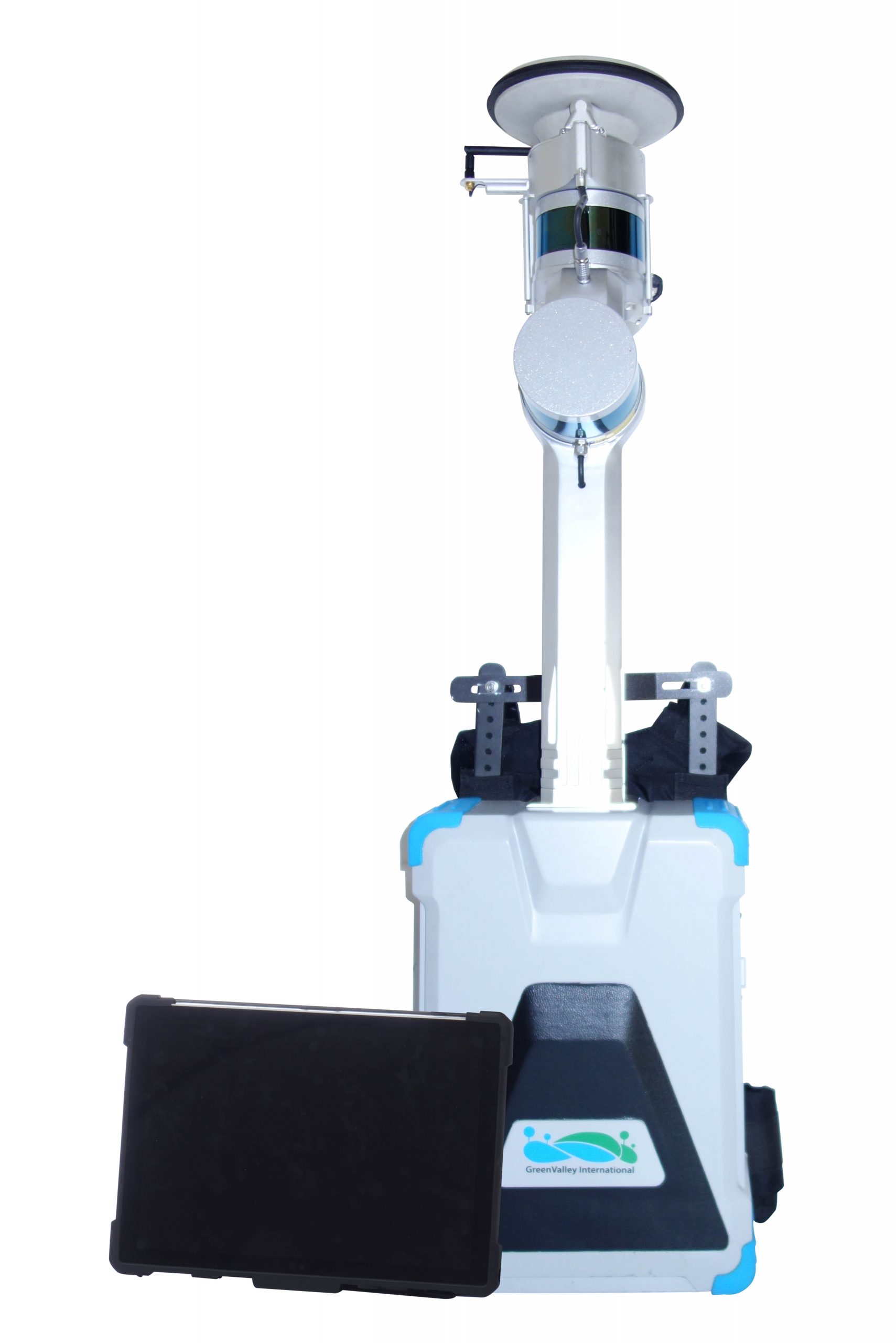
Highly Accurate Positioning Information
The absolute accuracy of the point cloud model after post-processing by DG50’s complementary software Libackpack Desktop is ~5cm.
Indoor and Outdoor Scanning Capability
Acombination of outdoor and indoor enviroment can be handled by DG50 with a well-olanned scanning route.
Improved SLAM Solution
The 3D modeling performance of DG50’s SLAM solution is improved by intergrating the absolute positioning information provided by the GNSS module.
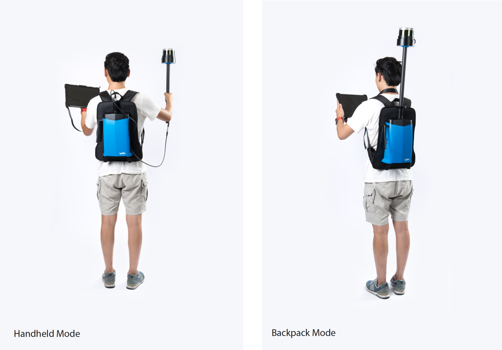
LiBackpack C50
LiBackpack C50 is an advanced SLAM-based 3D mapping system which integrates LiDAR and 360° imaging technologies to produce true color point clouds. Functional in both handheld and backpack modes, the LiBackpack C50 is a flexible mobile laser scanning solution for indoor and outdoor applications. Users can opt for a LiDAR-only solution when colorized point clouds are not required.
360° Camera + LiDAR Integration
Operational Versatility
The LiBackpack C50 is functional in both handheld & backpack modes. the Backpack mode allows for a true hands-free experience while the Handheld mode offers a wide FOV
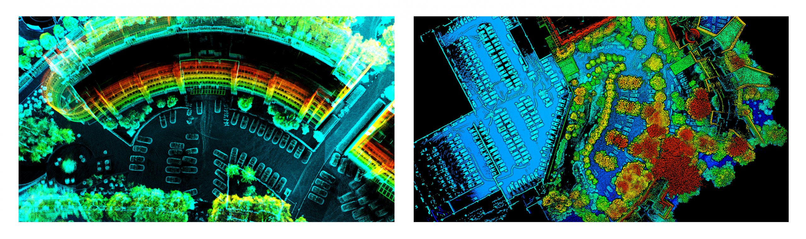
Real-Time Data Visualization
Visualize the point cloud in real-time via the connected device(wired/wireless) The LiBackpack user interface also displays device status information.
Advanced SLAM Solution
Robust SLAM algorithms that includes automatic loop closure & asystem capable of producing a real-time point cloud.
LiBackpack 50
LiBackpack 50 enables users to accurately acquire rich 3D point cloud data quickly and efficiently. Integrating LiDAR with SLAM (simultaneous localization & mapping) technology allows for seamless real time SLAM registration and scanning capabilities in both indoor/outdoor environments The LiBackpack 50 is operable in both Handheld and Backpack modes, which offer versatility in a number of applications such as forestry and stockpile volumetrics. Real-time point cloud data streaming via the intuitive user interface to any device allows users a rapid understanding of the 3D environment. During & after scanning, users can instantly visualize data which includes path of travel, intensity and time-stamp information.
LiDAR & SLAM Integration

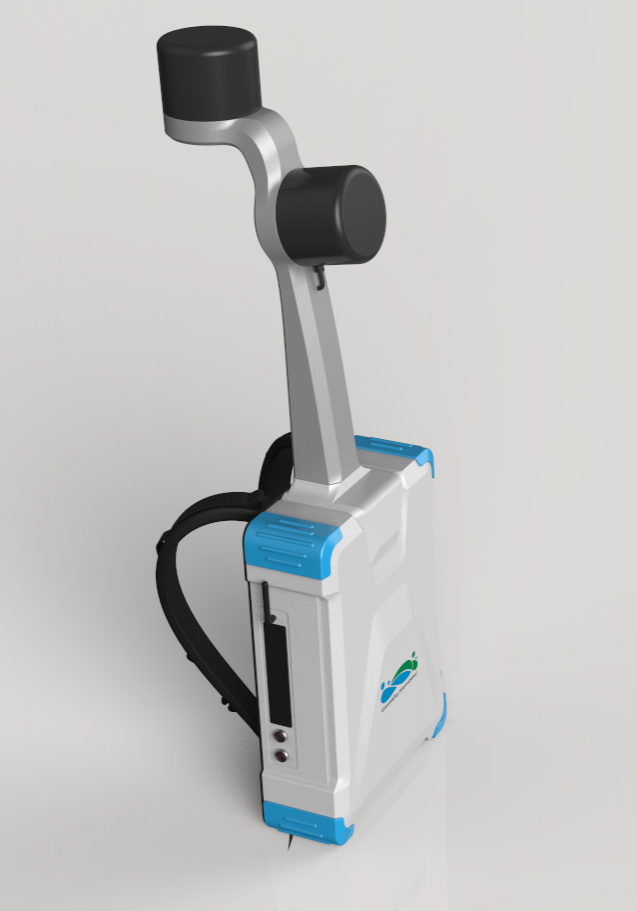
LiBackpack D50
LiBackpack D50 is GVI’s premium mobile mapping system, comprising of two Velodyne VLP-16 LiDAR sensors. The D50 is able to capture twice as many points which, in turn, further assists our SLAM algorithm in providing both accuracy and scanning robustness. By including dual-laser sensors, 3 dimensional features within the point cloud are more well-defined compared to other mobile mapping systems. All of this is provided in a durable, lightweight housing – giving users the ability to scan vast areas for up to 2 hours.
• Real time SLAM registration
• Process data as you scan
• Real time point cloud visualization
• Scan both outdoor/indoor environments
• Visualize trajectory in real time to ensure full scan coverage
• Post-process data in LiDAR360
Learn More

LiBackpack-C50
LiBackpack-D50
LiBackpack-DG50
LiBackpack-DGC50