

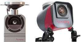
imajbox® sensors
Highly portable, automated and efficient 3D laser scanner.
Learn More +
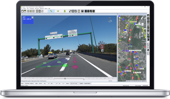
imajview® GIS software
imajview® is a photogrammetric software suite developed to extract GIS data from imajbox® surveys. It allows the exploitation of these readings for transportation infrastructures and utilities inventory, studies and maintenance purposes.
Learn More +