PRODUCT
HOME>PRODUCT>Capturing Reality>Create 2D/3D Maps
Create 2D/3D Maps
Perfect solution for mappers
Create your own 3D model
RealityCapture is a perfect solution for your mapping projects. You can create infinite number of ortho-projections and maps. For each map, area and volume measurements are automatically calculated. Moreover, you can use several options how to geo-reference your map and with control point experience, you are able to create hundreds of measurements for ground control points within minutes.
Map Wizard
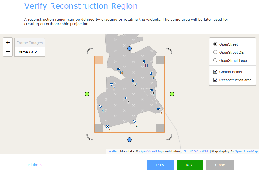
It is an easy and intuitive tool enabling you to have end-to-end results in one place.
It works in few simple steps:
• Drag & Drop images or laser scans
• Import flight log, GCPs or CPs
• Define your goal
• Press GO and obtain geo-referenced map

Geo-referencing
• Flight logs
• GPS coordinates in EXIF
• Ground control points
Maps/DSM
• Google earth: KML/KMZ
• GIS software file format: GeoTiff
Arbitrary orthographic projections
You are not limited just to maps with your projects. You can create arbitrary orthographic projections and cross-sections.You can define the projection plane, size and rotation of the projection area and get the resolution you need. All ortho-projections are saved and can be exported as image, altitude or depth layer. This feature is very useful for project documentations.


