


PRODUCT
HOME>PRODUCT>nctech>iSTAR Pulsar+


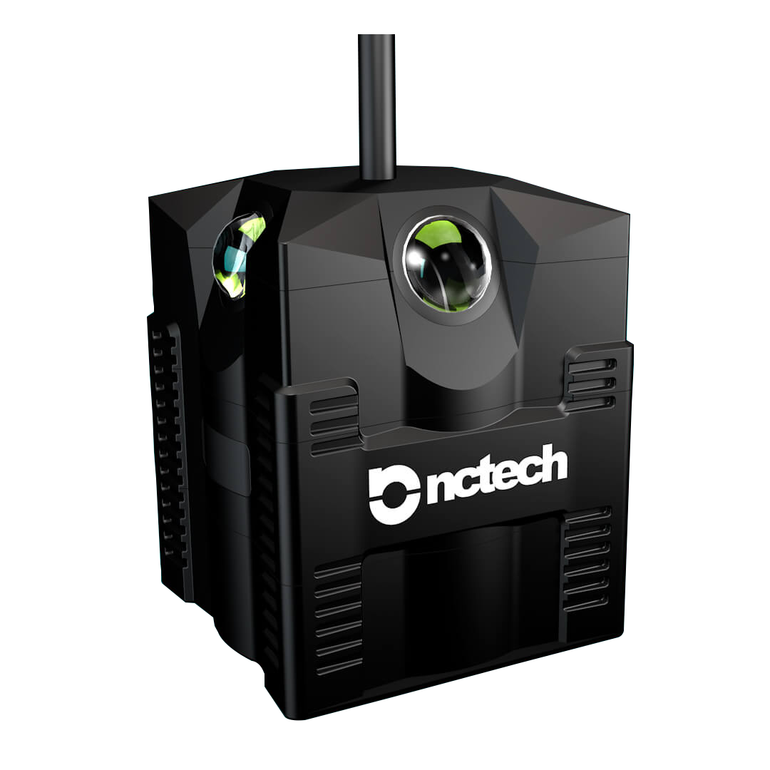
iSTAR Pulsar makes it easy for anyone,
anywhere to capture the world around them in high resolution panoramic imagery.
Requiring no photography experience or even a computer,
this ground-breaking device allows you to effortlessly capture,
upload and publish your world to Google Street View.
Designed in collaboration with Google,
iSTAR Pulsar is the world’s first professional edge-to-cloud imaging system certified for the Google Street View platform.
iSTAR Pulsar gives you
High resolution output
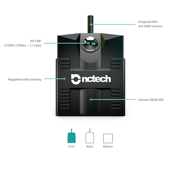
iSTAR Pulsar’s unparalleled 11K 360-degree resolution offers almost four times the resolution of standard 8K spherical systems, delivering incredible 60.5 megapixel panoramic images at up to 7fps.
Intelligent design
Optimised for mobile platforms, iSTAR Pulsar dynamically adjusts capture rate to provide consistent distance interval spacing, minimising data storage and processing requirements. Weighted metering analysis ensures zones of high interest are always perfectly exposed.
Ready-to-go calibration
Every iSTAR Pulsar system is fully calibrated to sub-pixel level. Combined with our own advanced depth stitching process, this allows capture speeds of up to 70mph. Unlike other stitching methods such as optical flow, our process does not suffer from double data, bending, flickering or blurring.
Edge-to-cloud processing with VR.World
Your captured data is conveniently uploaded directly from the device to our VR.World platform via a Wifi connection. Using powerful cloud computing tools, VR.World image processing is automated and efficient, freeing-up your local computer resources and saving time and money.
Key application and market sectors
Destination marketing
- Capture your destination in immersive panoramic imagery for visitors to explore on Google Street View
- Enjoy greater control of conditions compared with routine GSV captures
- Add branding to your capture to enhance your presence on the platform
Home developer capture
- Get new developments onto GSV as soon as you’re ready without waiting for routine captures
- Control the date, time and route of capture for optimum appeal
- Add branding to your capture to enhance your presence on the platform
Business showcasing
- Ensure the most up-to-date imagery of your site or business on GSV
- iSTAR Pulsar offers the highest resolution imagery for GSV
Under the hood
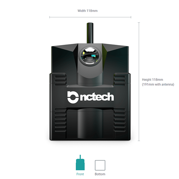
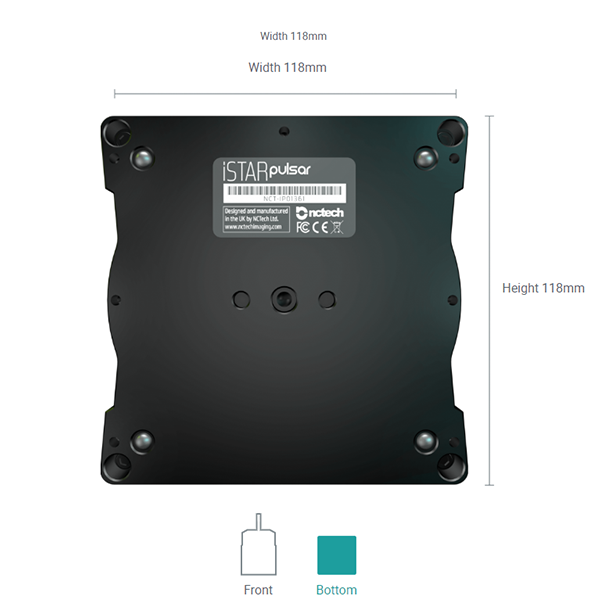
Dimensions
Features
Specifications
| Dimensions | 118 x 118 x 143mm (191mm with antenna) | Weight | 2.1Kg |
| 360 Resolution | 60.5MP (11000 x 5500px - 2:1 ratio) | Storage | 256GB |
| System | Extended OSC API | Image Recording Format | .onctd Proprietary Encrypted File Format |
| Frame Rate | .Up to 7fps | Sensor | 4 x Sony Exmor RS |
| Sensor Size | 4 x 12.3MP (3042 x 4062) | Lens | 4 x f/2.6 fisheye lenses |
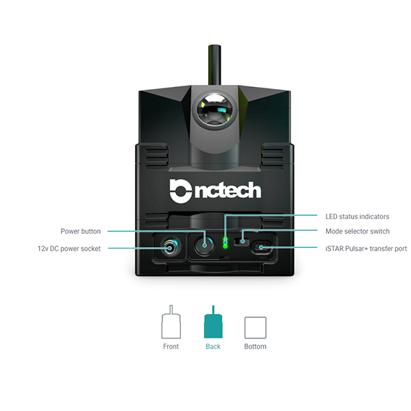
| FOV | 360 x 145 +/- 5deg | Power | 12v DC |
| Wireless Connectivity | 802.11 b/g/n/ac (2T2R) | GPS | U-BLOX Neo M8N (up to 3 GNSS) |
| GPS Antenna | Multi GNSS Helicore | IMU | 6-axis |
| Magnetometer | 3-axis | CPUs | 2 x Apollo Lake |
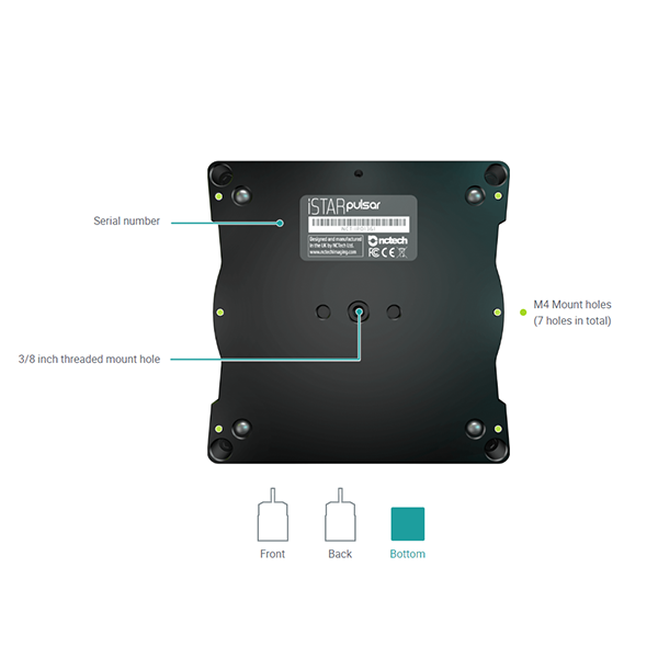
| Casing | CNC Hard Anodised Aluminium | IP Rating | IP64 |
| Regulatory Compliance | CE, FCC, RoHS | Operating Temperature | 0 - 50 Celsius |
| Shipping Box Size and Weight | 33 x 21 x 26cm - 3.6kg |

Our powerful cloud processing platform, VR.World, is designed to process, manage and share captured data from iSTAR Pulsar imaging systems. It gives you access to all the tools you’ll need to process, analyse and distribute your content from one platform, anywhere, anytime.
iSTAR Pulsar App
Featuring an easy to use, intuitive interface, the iSTAR Pulsar app is all you need to control iSTAR Pulsar
Which iSTAR Pulsar is for you
| Features | iSTAR pulsar | iSTAR pulsar+ |
|---|---|---|
| Capture method | Mobile | Mobile |
| 360 image resolution | 60.5MP (11000×5500) | 60.5MP (11000×5500) |
| Shutter speed | 1- 1/16000 | 1- 1/16000 |
| IP rating | IP64 | IP64 |
| Maximum Frame Rate | 7 fps | 7 fps |
| Storage | SSD (256GB) | SSD (256GB-1TB) |
| GPS Receiver | U-BLOX Neo M8N | U-BLOX Neo M8N |
| Online processing via VR.World | O | O |
| Publish to Google Street View | O | O |
| Geospatial Capture Spacing | O | O |
| Transfer data via USB‐C | - | O |
| Offline processing (requires DFL) | - | O |
| Sync to external GPS/IMU | - | O |
| SDK | - | O |
Learn More

iStarPulsarPlus-brochure